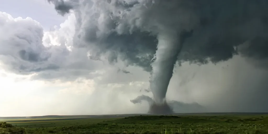
A tornado | Source: Getty Images
Breaking Weather Alert: Tornado & Severe Thunderstorm Watches Issued
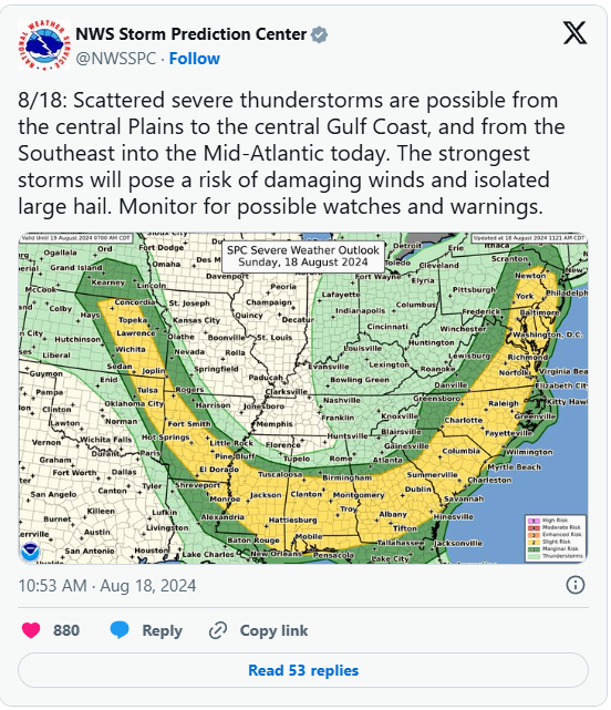
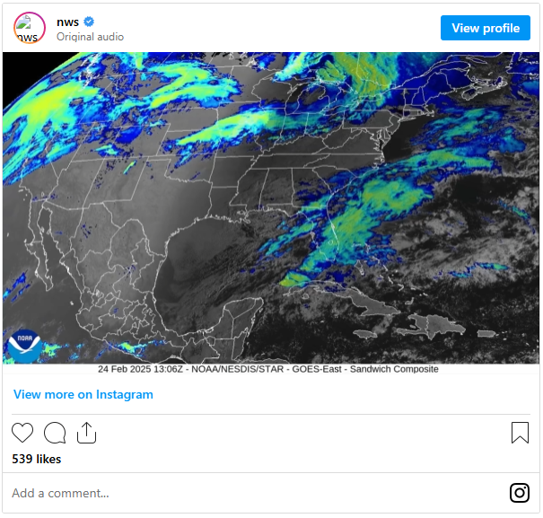
The Storm Prediction Center has released urgent tornado and severe thunderstorm watch alerts for multiple U.S. states. Stay informed with the latest updates on affected areas and what to expect as these dangerous weather conditions develop.
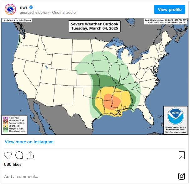
Severe Weather Alert: High Risk for Central Oklahoma & North Texas
The Storm Prediction Center (SPC) has issued an Enhanced Risk warning for severe thunderstorms across central Oklahoma and parts of north Texas, making these regions among the most vulnerable to dangerous weather overnight. Kansas is also included in the affected areas. Stay prepared and follow safety updates closely.
Severe Storms Expected to Intensify Across Southern & Central Plains
According to the March 3, 2025 outlook, thunderstorms are forecast to develop across portions of the southern and central Plains during the evening, with increasing intensity as the night progresses.
Key Threats:
🔹 Tornadoes – Some storms may produce isolated tornadoes.
🔹 Damaging Wind Gusts – High winds pose a threat to structures and power lines.
🔹 Large Hail – Potential for destructive hail impacting multiple states.
Residents in affected areas should stay alert and be prepared for rapidly changing conditions.
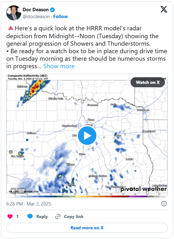
Storm Threat Intensifies as Powerful Weather System Moves East
A mid-level short-wave trough moving out of the Four Corners region is set to track eastward into the central and southern Plains, creating the perfect setup for severe storms.
At the surface, a cold front surging across the High Plains is colliding with a warm, moisture-rich air mass, fueling atmospheric destabilization—especially over western Oklahoma and western North Texas. This clash is priming the region for severe thunderstorms, tornadoes, damaging winds, and large hail.
Residents should stay alert as conditions rapidly evolve.
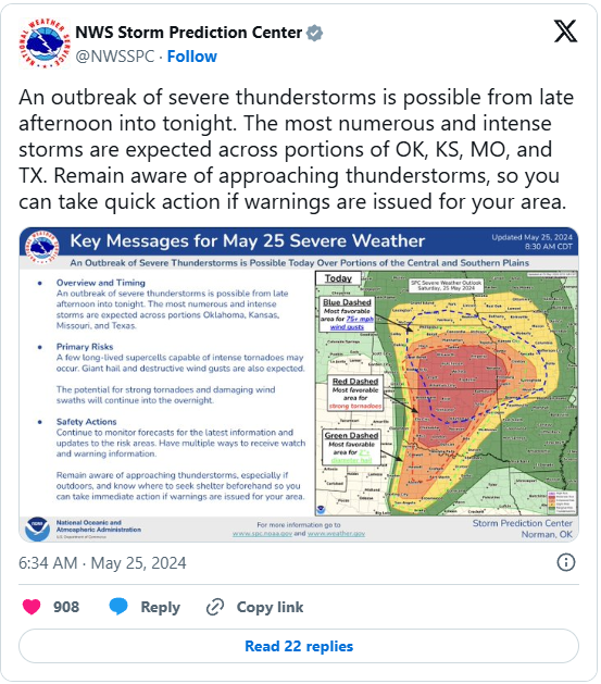
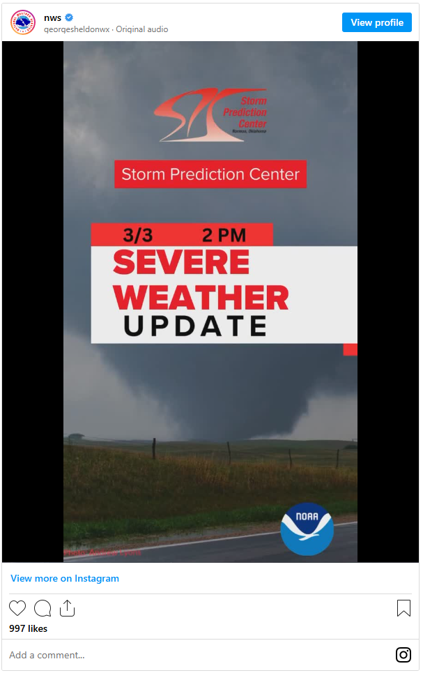
Severe Storms Strengthen as Energy Builds Across the Plains
Meteorologists are tracking mixed-layer CAPE values near 1000 J/kg, a key measure of atmospheric energy available to fuel severe storms.
🌩 Storm Evolution Timeline:
🔹 Evening of March 3: Initial storms are expected to be slightly elevated, making large hail the primary hazard.
🔹 Overnight: As the cold front pushes east, storms will intensify and organize into a powerful linear system, tapping into the unstable warm sector.
🔹 Upscale Growth: This transition will make storms more surface-based, significantly increasing the risk of damaging winds and embedded tornadoes.
Residents in the affected areas should be prepared for rapidly worsening conditions and have a safety plan in place.
Severe Storms to Intensify, Bringing Dangerous Winds & Tornado Threat
As storms undergo upscale growth, they will become more surface-based, dramatically increasing the threat of damaging winds and embedded tornadoes overnight.
High-Risk Areas:
🔴 Enhanced Risk Zone (Highest Threat) – Over 3.2 million people at risk
📍 Oklahoma City, Norman, Wichita Falls, Denton
🟡 Slight Risk Zone (Severe storms still possible)
📍 Dallas, Fort Worth, Tulsa, Wichita
Residents in these areas should stay weather-aware and be prepared to take shelter if warnings are issued.
Severe Weather Expands Across the Plains & Tornado Watch in Effect
The Marginal Risk zone extends even further, reaching areas like Kansas City, Omaha, and Topeka, indicating that while the highest threat is concentrated further south, strong storms could still develop across the central Plains.
Tornado Watch Alert:
🔺 Active Tornado Watch issued for:
📍 Southwest Arkansas, Southern & Southeast Oklahoma, Central to Northeast Texas
Residents in these areas should be on high alert for potential tornado development and other severe weather hazards. Stay tuned to local weather updates and be ready to take action if warnings are issued.

Tornado Watch in Effect: Critical Window for Dangerous Weather
A Tornado Watch has been issued starting at 4:10 a.m. CST today (March 4) and will remain in place until 11:00 a.m. CST. This watch covers a crucial time period when dangerous storms are expected to move through the region.
Primary Threats:
🌪 Tornadoes – A few tornadoes are possible.
💨 Damaging Winds – Winds could gust up to 75 miles per hour.
Residents within the Tornado Watch area should be ready to take shelter if warnings are issued and stay updated on weather conditions.
Intensifying Storms Bring Additional Threats Across Tornado Watch Area
Forecasters are also warning of the potential for isolated large hail, with hailstones reaching up to 1.5 inches in diameter. This heightened risk is driven by an intensifying squall line, rapidly moving eastward across the Tornado Watch area.
Key Hazards to Expect:
🔹 Large Hail – Hailstones could reach up to 1.5 inches in diameter.
🔹 Squall Line – This fast-moving line of storms is expected to maintain its strength as it tracks toward more densely populated areas throughout the morning hours.
Residents in the path of this system should be prepared for rapidly changing conditions and be ready to seek shelter if severe weather impacts their area.
Additional Storm Risks as Squall Line Approaches: Stay Alert
Compounding the danger, a few storms may form ahead of the main squall line, increasing the potential for isolated tornadoes and severe weather impacts.
Tornado Watch Area:
The watch covers a 105-mile-wide zone, stretching from 20 miles west-northwest of Poteau, Oklahoma, to 25 miles southeast of Waco, Texas.
Residents within the watch area should stay weather-aware, monitor local weather alerts closely, and remain vigilant for any additional warnings or updates.

What is a Tornado Watch?
A Tornado Watch is issued when conditions are favorable for tornado development, meaning tornadoes could form in or near the designated watch area. This serves as a signal for residents to be prepared—not because a tornado is already occurring, but because the atmosphere has all the right ingredients for dangerous storms that may produce them.
Key Facts:
🔹 Tornado Watches are wide-ranging, often covering multiple counties or even several states.
🔹 They are issued by the Storm Prediction Center when severe weather conditions are likely.
Residents should use the watch as a cue to prepare for potential tornadoes by reviewing emergency plans and ensuring they have access to reliable weather alerts.

Tornado Watch: Take Action and Stay Safe
When a Tornado Watch is in effect, it’s essential to use this time wisely to prepare:
🔹 Review Emergency Plans – Ensure everyone knows what to do if a tornado warning is issued.
🔹 Check Your Safe Room or Storm Shelter – Make sure it’s clear, accessible, and ready to be used if necessary.
🔹 Access Reliable Weather Alerts – Stay informed through weather apps, radio, or local news.
🔹 Inventory Emergency Supplies – Ensure you have essentials like water, batteries, flashlights, and a first-aid kit in case you need to shelter quickly.
Acting early, before a tornado forms, is one of the best ways to protect yourself and your family. Preparedness can make all the difference when severe weather strikes.
Understanding Tornado Watches, Warnings, and Emergencies
It’s important to note the differences between various severe weather alerts:
- Tornado Watch: Conditions are favorable for tornado development in or near the area.
- Tornado Warning: Issued when a tornado has been either sighted or detected by weather radar.
- Tornado Emergency: Declared when a violent tornado has touched down in the watch area, indicating an urgent threat.
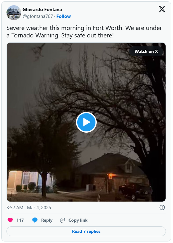
Social media platforms like X are already abuzz with firsthand reports, including a post from a civilian in North Texas who noted the sound of a tornado siren. Stay alert and follow reliable updates to keep safe during these severe weather events.
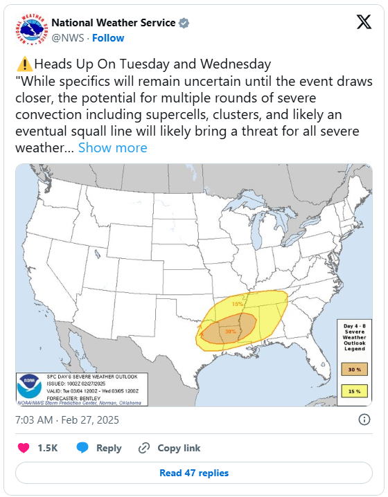
Major Winter Storm Alert: Brace for Severe Weather Across the Central U.S. and Beyond
In addition to the ongoing severe thunderstorm and tornado watches, the National Weather Service’s Weather Prediction Center has issued a new alert for a major winter storm expected to hit the Central U.S. through the middle of the week. This powerful system could unleash a variety of dangerous weather conditions:
- Blizzard Conditions: Heavy snow and reduced visibility could disrupt travel and daily activities.
- Damaging High Winds: Strong gusts may lead to property damage and power outages.
- Flash Flooding Risk: Parts of the Plains, Midwest, and Great Lakes region could see sudden flooding events.
Residents in the affected areas should monitor local forecasts, prepare for rapidly changing conditions, and ensure their emergency plans and supplies are in order.
Major Winter Storm: Heavy Snowfall and Blizzard Conditions Across the Rockies and Beyond
The storm is already unleashing heavy snowfall in the higher elevations of the Central Rockies, where accumulations could reach one to two feet. As the system moves farther east, expect a swath of four to eight inches of snow accompanied by intense winds, setting the stage for blizzard conditions across parts of the Central High Plains and into the Upper Midwest. In some areas, snowfall may even approach a foot.
Residents in the affected regions should prepare for rapidly deteriorating weather conditions by monitoring local forecasts, securing necessary supplies, and following any official advisories.
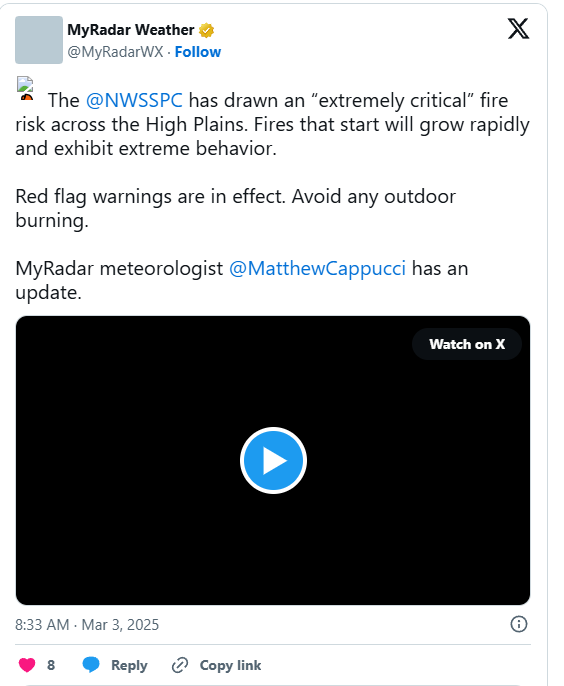
Extreme Fire Weather Alert: Heightened Risk Across the Southwest Plains
On the warmer side of the storm, a separate threat is emerging across parts of New Mexico, southeast Colorado, southwest Kansas, western Oklahoma, and western Texas. In these areas, strong winds and dry air are combining to create conditions ripe for extreme fire weather, dramatically raising the wildfire risk.
The Prediction Center’s latest Fire Weather Outlook emphasizes this heightened danger, urging residents to stay vigilant and monitor updates closely.
Severe Weather Outlook: Dual Threats on the Southern and Southeastern Flanks
Meanwhile, the southern and southeastern edges of the storm are stirring severe weather concerns, particularly across the Red River Valley into the Lower Mississippi Valley. Warm, moisture-laden air streaming from the Gulf of Mexico is set to fuel an environment ripe for strong to severe thunderstorms.
Additional hazards include:
- Heavy Rainfall: Expected to drench parts of the Midwest and Mid-South.
- Excessive Rainfall Risk: The Weather Prediction Center has issued a Slight Risk for localized flash flooding, emphasizing the potential for sudden, intense downpours.
Residents in these regions should remain vigilant, keep abreast of evolving weather updates, and prepare for rapidly changing conditions.
Storm Evolution: Shifting Impacts from East to West Coast
As the system moves eastward, attention will shift toward the Mid-Atlantic and Southeast regions. Here, the main concerns will be damaging winds and the possibility of a few tornadoes, though the overall risk is expected to be slightly lower compared to areas further west.
Meanwhile, a new storm system brewing in the Pacific is set to hit California by Wednesday. This system will bring heavy rain to the coast and deliver significant snowfall to the Sierra Nevada, adding another layer of weather challenges.
Residents across these regions should stay informed and be ready to adapt to the evolving weather conditions.

Unpredictable Weather Unleashes a Nationwide Impact
This evolving, multi-faceted weather pattern highlights the rapidly shifting conditions gripping much of the country this week. From blizzards and extreme fire weather to severe storms and sudden flash floods, communities across the central and southern United States are bracing for an intense, high-impact period of weather. Residents in multiple states remain on high alert as nature’s extremes continue to reshape the forecast.