🌪️ HURRICANE HAL’S TROPICAL WEATHER UPDATE
📅 MONDAY, SEPTEMBER 23 | ⏰ 11:00 AM EDT / 10:00 AM CDT
🚨 BREAKING NEWS
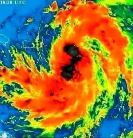
The National Hurricane Center (NHC) has officially started issuing advisories on Potential Tropical Cyclone Nine, expected to be named Tropical Storm Helene later today or tonight.
🌀 The Big Picture:
Helene is projected to form in the northwestern Caribbean and rapidly strengthen into a hurricane as it moves into the Gulf of Mexico. By Thursday, it could impact areas from the Florida Panhandle to West Central Florida with Category 2 or 3 hurricane-force winds, storm surge, and heavy rainfall—potentially affecting Florida, Georgia, and South Carolina.
🔍 In Detail:
- Formation & Tracking:
A cluster of disorganized thunderstorms is expected to develop a defined center of circulation later today or tonight. Once it does, it will likely be named Helene and track through the Yucatan Channel before intensifying over the Gulf of Mexico. - Forecast Path:
Current models suggest a north to northeast track, with a broad strike zone from the Florida Panhandle to the West Central Florida coast. - Storm Strength:
Rapid intensification is possible. The NHC predicts sustained winds could reach up to 110 mph, placing the storm near the Category 3 threshold. - Uncertainty:
Until a clear center of circulation forms, forecast uncertainty remains high. Expect shifts in track, intensity, and timing. - Wind Field Impacts:
This system is expected to develop a large wind field, especially east of the eye. While larger storms may intensify more slowly, they also bring widespread wind and surge impacts across extended areas. - Avoid “Line-Track” Fixation:
Don’t focus solely on model “spaghetti lines.” These represent potential eye paths—not the full wind field, which could extend far beyond those lines. - Preparation Tips:
Always prepare for one category stronger than forecast. Residents from the Florida Panhandle to West Central Florida should take this system very seriously and consider the possibility of Cat-3 conditions. - Inland Risks:
As the storm accelerates near landfall, wind impacts could spread well inland into Georgia and South Carolina. - Storm Surge Threat:
Due to Florida’s coastline shape and shallow waters, areas from the Big Bend to West Central Florida are particularly vulnerable to severe storm surge flooding. Additional surge risks may arise in Northeast Florida, Georgia, and South Carolina, depending on the storm’s track. - Preparation Timeline:
Once the storm’s center forms, communities will have just 60–72 hours before potential landfall. Prepare now—expect crowded stores and gas stations by Tuesday as evacuation and prep efforts ramp up.
📢 Final Word from Hurricane Hal:
If you’re in the potential impact zone, review your disaster plan today and begin any critical preparations immediately. The next 48–72 hours are crucial.
📊 GRAPHICS INCLUDED:
- NHC Best Track Forecast – Potential Tropical Cyclone Nine
- Probability of Tropical Storm Force Winds
- Euro Ensemble Track Map – via Tropical Tidbits
- GFS Ensemble Track Map – via Tropical Tidbits
🌀 Stay alert and stay safe. More updates coming soon.
– HH